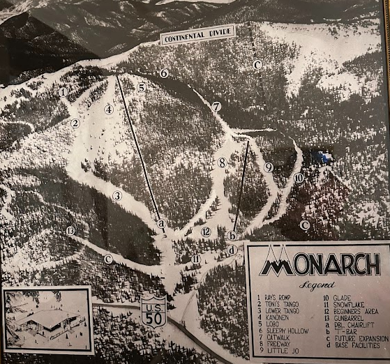
Exciting times at Monarch with the new No Name Basin trail map having been recently released and the updated front-side map yet to come. With that in mind, I wanted to refresh our readers on a bit of our trail map history with some posts I put out in previous years. I blogged about some of our earlier maps several years ago and you can review these here and with this link.
The map posted for today’s blog is framed up nicely here at a local business in downtown Salida. It shows the original Lift #1 (Original Garfield) and the old T-Bar along with thoughts of future expansion yet to come in the Breezeway and Panorama terrain. This map also shows the “new” base lodge which was installed between 1963 and 1965, so it’s likely this map was from that timeframe as well. It’s amazing to see where we were, how far we have come, and where we are going next.