Lately, it feels like we’ve been living in the jet stream. Over the course of the last week we have had several days with extreme winds that have presented challenges in operating the ski area. Anyone who has ever seen a video or two of a chairlift in high winds will clearly understand why ski area operators place ski lifts on a wind hold during these types of extreme wind events.
On Wednesday-February 15th we saw an extreme “upslope” event that brought high winds from the NE. These are the exact opposite direction that we typically see winds from (SW). So, operations were literally approached from 180° of what is normal. This is why we could only run the Breezeway Lift (which is almost always the first lift to be closed down on blustery days with our prevalent SW winds). I described this day’s events in an earlier post last week.
On Sunday-February 19th and on Wednesday-February 22nd we experienced extreme winds with a SW and SSW wind direction that initially placed several lifts on a wind hold before eventually shutting down ski area operations all together. While this is the predominant wind direction that we are used to operating in, when wind speeds get into these higher parameters the only choice is to place lifts on a wind hold. Several other days this week also saw the Breezeway lift’s operations affected by strong SW winds.
I am completely in tune and understand how guests may be disappointed to drive up to the ski area only to have a diminished experience with reduced lift access or a shortened day altogether. However, safety is always our first priority for staff and guests. Here are a few tips for some helpful trip planning and an insight into Lift and Mountain Operations on these types of challenging weather days.
While forecasting has gotten much more accurate as technology improves, even now weather forecasters are not always 100% correct. At best it’s still an educated guess. Even so, forecasts are an essential tool for operating a ski area or when planning your day on the slopes.
If you see forecasted wind gusts from the W or SW in the 50+mph range, you should anticipate possible wind holds on Breezeway, Tumbelina and Pioneer. In the 60+mph range from any direction you should expect some lifts to close and the high probability for all lifts to be impacted. Anything above this into the 70+mph range and it’s almost guaranteed that we will be closing all lifts.
For an upslope event like we saw on Feb 15th, expect winds to be traveling up the Panorama and Tumbelina lift lines and diagonally across the top of the Garfield and Pioneer lifts from rider’s left to right. As I mentioned, Breezeway can be less affected by these types of winds. For W and SW winds we see it blow across Breeze at Docs and near the top. Garfield, Pioneer and Tumbo will see these winds just at the top stations. N and NW winds do not affect our lifts quite as bad although Tumbelina can sometimes be affected by a northerly wind. We also don’t see a lot of these N and NW wind directions in the Sawatch Range as the mountains provide a topographic barrier.
While this info provides some insight into how winds can affect our lifts, realize that every weather event is a little different and that there are many variables throughout the day and night that go into making operational decisions. Administration coordinates closely with our Lift Maintenence, Lift Operations, Slope Maintenance and Ski Patrol Departments about daily lift and trail decisions.
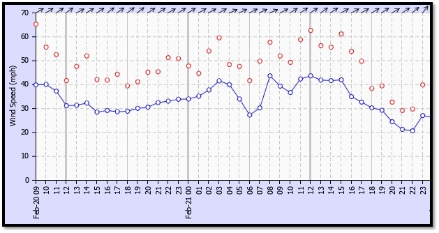
On our website we list some weather data on our conditions page. This real-time data is from a station located in the base area. So, the weather on the ridgeline is much different than what is directly outside the lodge. For ridgetop winds and weather data, please visit the CAIC website to see weather stations around the state. Our station located at the top of Mirkwood is listed on this page under the Sawatch Range/Monarch Mountain. Hover and click on the words “Monarch Mountain” for a graph depicting recent weather data from this station.
For weather forecasts, we utilize Open Snow (membership required but a 5 day forecast is provided on our conditions page), NWS and the CAIC website. On the NWS site you can click “3-Day History” under “More Information” to a direct link to a weather station located at 12,000′ on top of Monarch Pass. This site is also listed on the CAIC page. You can also click on the “Hourly Weather Forecast” chart on the lower right for details on the upcoming weather For even more detailed ridgeline forecast data, we rely on the CAIC point forecast. While not perfect, this forecast is fairly reliable once you are inside 6-12 hours of the anticipated forecast time. Click on the “Sawatch” Range dropdown tab, then click on the Monarch Pass Graph/View for a detailed hourly forecast. For even more detail, change the weather model to the WRF HiRES version using the dropdown higher up on the page.
There is a lot that goes into ski area operational decisions. Things CAN AND DO CHANGE hour by hour and even minute by minute in the mountains. Keep an eye on the weather forecasts along with local weather station data to help you make an educational decision prior to your visit. There has never been more resources available to use with multiple weather forecasts online, webcams and social media. Even so, Mother Nature always keeps you guessing. Enjoy!